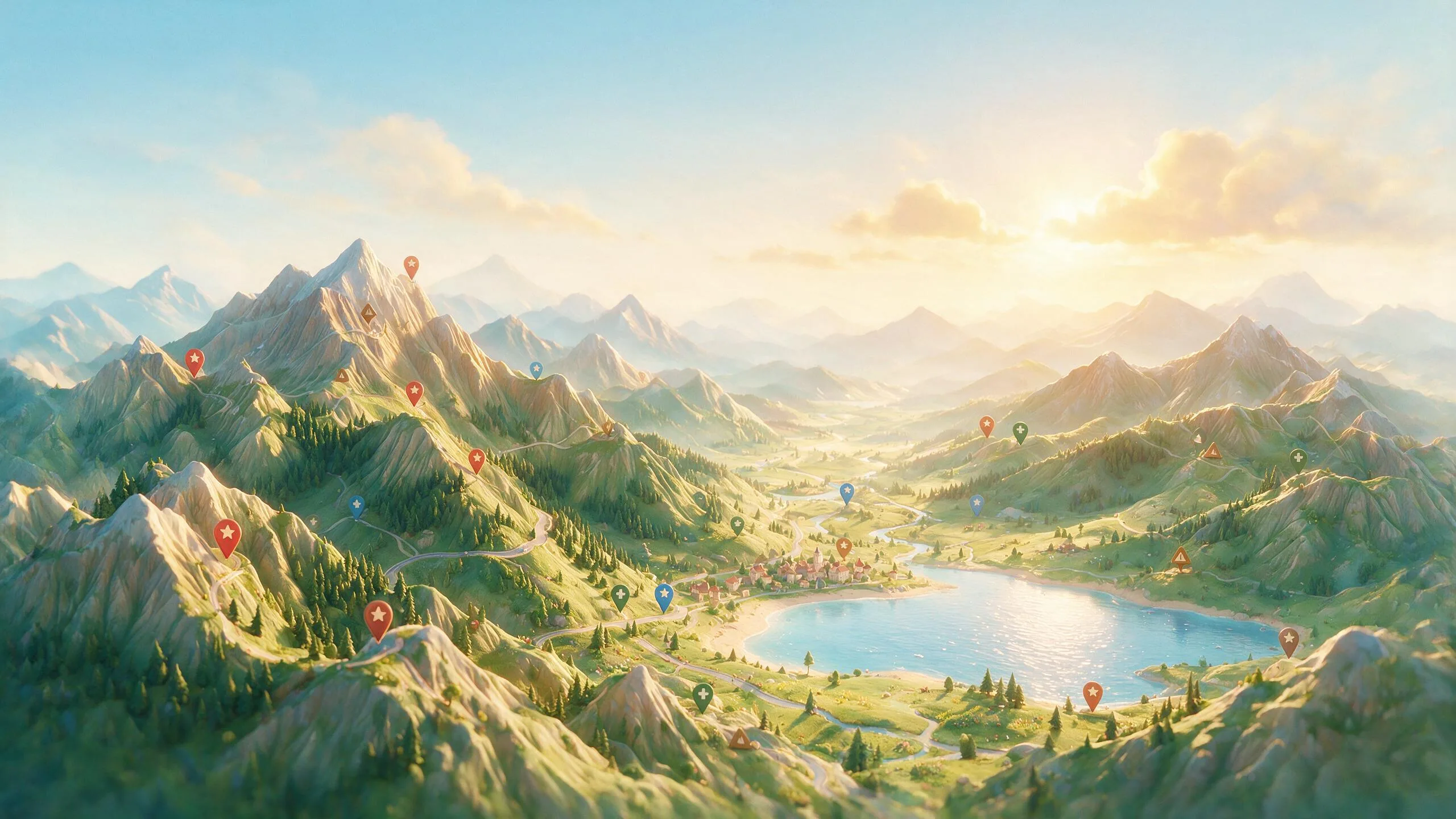
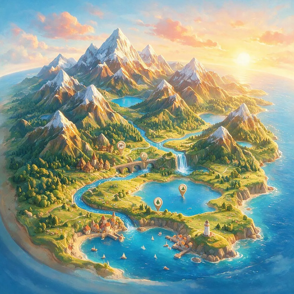
Name a country, a city, or a fandom's whole world and get back a raised-relief travel poster with the terrain sculpted in true 3D. Relief Map Studio pushes mountains, valleys, rivers, and coastlines up off a clean gradient base, lights them like a travel guide at golden hour, and drops a handful of tidy landmark pins — real geography keeps the place instantly recognizable. Print-ready and framable, so every trip, itinerary, or new obsession becomes its own wall piece.
3D Relief Map Generator — Relief Map Studio
Relief Map Studio is a 3D relief map generator that turns a place name — a country, a city or a fandom’s whole world — into a raised-relief travel poster with the terrain sculpted in true 3D. It pushes mountains, valleys, rivers and coastlines up off a clean gradient base, lights them like a travel guide at golden hour, and drops a handful of tidy landmark pins so the place stays instantly recognizable. The result is composed as print-ready, framable wall art, so a trip, an itinerary or a new obsession becomes its own wall piece. Because the studio runs as a session with memory, you can refine the palette, pins and lighting across rounds without the map redrawing itself.
Terrain sculpted in true 3D from a place name
Type a place and the agent builds its landscape as sculpture: mountains, valleys, rivers and coastlines pushed up off a clean gradient base rather than drawn as flat cartography. A poster of Japan renders the central Alps as a raised ridge casting soft shadows; a coastal country gets its shoreline cut in believable relief. For real places the geography stays recognizable — the terrain sits where it actually is — which is what makes the poster read as that place rather than a generic mountain graphic.
Travel-guide light and tidy landmark pins
The styling borrows from the covers of good travel guides: warm golden-hour light raking across the relief so every ridge throws a soft shadow, and a restrained palette on a clean gradient base. On top of the terrain, the agent drops a handful of slim landmark pins — Tokyo, Kyoto, Mount Fuji — and keeps the set deliberately sparse. A poster with five tidy pins reads as designed; one with thirty labels reads as clutter, so the pin discipline is part of the look.
Fantasy and fandom worlds as travel posters
The same treatment works on places that never existed. Name a fandom’s world and the agent styles its terrain as a warm travel guide — the Misty Mountains rising in true 3D, sparse pins marking the Shire, Rohan and Mordor — turning a fictional map into the kind of poster a tourist board might have printed. It is a different way to own a world you love: not an illustration of a scene, but the geography itself, framed.
Refine your map poster in a session
A wall piece is worth iterating on. Relief Map Studio runs as a session with memory, so you can swap the palette, add or remove a landmark pin, or shift the lighting warmer, and the agent adjusts that one variable while the terrain and composition you have already approved stay put. When the poster is right, download it print-ready at full resolution and frame it.
What you can create with Relief Map Studio
- Raised-relief travel posters of any country or region
- City maps with sculpted terrain and tidy landmark pins
- Fantasy and fandom worlds styled as travel guides
- Print-ready, framable wall art for a trip or obsession
Sample prompts to try
- 🗾 A raised-relief poster of Japan at golden hour, the central Alps ridge casting soft shadows, slim pins for Tokyo, Kyoto, and Mount Fuji
- 🧙 A raised-terrain map of Middle-earth styled as a warm travel guide, the Misty Mountains rising in 3D with sparse pins for the Shire, Rohan, and Mordor
How to use Relief Map Studio
- 1Name a country, city or fictional world.
- 2Pick a palette and the landmarks you want pinned.
- 3Generate the raised-relief poster with golden-hour light.
- 4Download print-ready to frame.
Relief Map Studio vs. generic AI image tools
| Generic AI image tools | Relief Map Studio |
|---|---|
| Geography comes out invented or wrong | Real mountains, rivers and coastlines in the right places |
| Flat map graphics with painted-on shading | Terrain pushed up off the base in true raised relief |
| Labels render as garbled, cluttered text | A handful of tidy landmark pins that keep the poster clean |
| Every attempt starts from a blank prompt | A session with memory carries palette and pin choices forward |
| Output needs a designer before it can be printed | Composed as framable, print-ready wall art |
Who should use Relief Map Studio
Travelers commemorating a trip
Turn the country you crossed or the city you fell for into a raised-relief poster with your own stops pinned — a wall piece that carries the itinerary in it.
Gift makers
A sculpted map of someone’s home country, honeymoon route or favorite city is a personal gift, and the session lets you tune the palette and pins until it fits them.
Fans of fictional worlds
Middle-earth, a game map, an invented realm from your own writing — styled as a warm travel guide with 3D terrain and sparse pins for the places that matter.
Home decorators and print sellers
Raised-relief travel posters are a coherent print series: same style, different places. Generate a set in one palette for a gallery wall or a shop listing.
Frequently asked questions
Is the geography accurate?
For real places, the agent keeps recognizable terrain — mountains, coastlines and rivers in the right places — so the map reads true while styled as a raised-relief poster.
Can I make a fictional or fandom map?
Yes. Name a fandom world and the agent styles its terrain as a warm travel guide with 3D ridges and sparse pins for the key locations.
Is it print-ready?
Yes. The output is composed as framable wall art and downloads at full resolution, so you can print it for a trip, an itinerary or a new obsession.
Can I choose which landmarks show?
Yes. You can call out the cities or landmarks you want pinned, and the agent keeps the pin set tidy so the poster stays clean.
Can I change the palette or pins after generating?
Yes. The studio runs as a session with memory, so you can swap the color palette, add a pin or warm up the light and the agent adjusts that variable while keeping the terrain and composition you approved.
How is this different from a normal map poster?
A flat map is drawn; a 3D relief map generator sculpts the terrain, so ridges rise off the base and catch golden-hour light with real shadows — closer to the raised-relief maps in a visitor center than a printed chart.
How much does it cost?
You can start for free. Paid plans add monthly credits — see the pricing page for current plans.
Related guides
- Best AI Image Generator 2026
- Prompting Image Agents Like An Art Director
- What Is An AI Visual Agent
- Ideogram 3
Part of ReelWand's Design tools — a focused suite of AI design studios.
More design agents
Relief Map Studio is one of 74 specialized visual agents on ReelWand. Explore the full catalog or browse the AI model guides. Start free, or see plans and pricing.